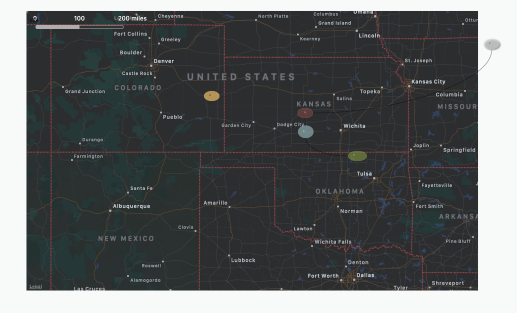
 A map adornment becomes a geographic adornment if all of the following evaluate as
 true:
- $Latitude is non-zero
- $Longitude is non-zero
- $Range is sufficiently large
The latitude and longitude may be set directly, or may be computed indirectly because $Address has been set. The scale of the map is determined by the adornment's $Range attribute, which represents the approximate size of the map in kilometres The scale of a geographic adornment’s map fill is fixed, and in relationship to the adornment's $Height & $Width.
Thus, dragging the adornment bigger will show more detail—i.e. appear to zoom in—as there is now more space within the adornment to plot the same $Range. The reverse applies for making the adornment size smaller. For a given adornment size, increasing $Range zooms the map out, decreasing it zooms in.
If a note that sits atop a geographic adornment has a latitude and longitude that lies within the adornment, it is moved so the note's centre lies on the corresponding place in the map. If the position is not on the map, the note is moved to the edge of the adornment. If a geographic adornment moves a note to a position that is already occupied, it will try to find a nearby place that is not occupied.
Geographic adornments can only draw maps up to about 8,000 pixels in size, which should be ample for most purposes.
If an adornment has a non-zero $Latitude or $Longitude (which it typically gains automatically if the adornment has an $Address), it becomes a geographic adornment and displays a map of the area surrounding that place. The extent of the map displayed is determined roughly by the attribute $Range, in kilometres; if not specified, the $Range is approximately 1km.
Data source for maps
Currently geographical adornments use Apple MapKit, via Tinderbox, to source the map's information.
See also—notes linking to here:
